As Papua New Guinea Pushes for Payments for Forest Conservation, New Analysis Says Nation May Be Running Out of Forests to Protect
Satellite Images Show that PNG is Rapidly Losing its Extensive Forest Cover,
Under Pressure from Industrial Logging, Agricultural Expansion and Forest Fires
For reactions to the report, click here
To view low resolution copies of images, click here
Download report extract – note this is about 1 Mb.
Download the full report – note this is about 24 Mb.
These are also available on an ftp site: ftp://files3.cyberlynk.net (Username: UPNG2008; Password: UPNG2008)
Port Moresby (2 June, 2008) – At the same time that the Government of Papua New Guinea is seeking compensation for conserving the carbon-trapping capacity of its vast tropical forests, destruction of these same lands is occurring so fast that by 2021 most of the areas accessible to loggers will have been cleared or degraded, according to a new report released today. The report uses high-resolution satellite imagery to reveal widespread and previously undetected losses.
The report, “The State of the Forests of Papua New Guinea,” was produced by scientists at the University of Papua New Guinea Remote Sensing Centre and their colleagues at the Australian National University. The researchers spent five years carefully analyzing satellite images that document 30 years of destruction in an area that contains a major portion of the world’s third largest tropical forest. Only the Amazon and Congo forests are bigger.
They estimate that in 2001, Papua New Guinea’s accessible forests were being cleared or degraded at a rate of 362,000 hectares a year – amounting to a combined annual rate of deforestation and degradation of 1.41 percent. At that pace, by 2021, the authors estimate that 83 percent of the country’s accessible forest (and 53 percent of its total forested area) will be gone or severely damaged. Scientists at the UPNG Remote Sensing Centre discovered that even in so-called conservation “protected areas” forest destruction is occurring at the same pace as in unprotected regions.
“Government officials may claim that they wish rich countries to pay them for conserving their forests, but if they are allowing multinational timber companies to take everything that’s accessible, all that will be left will be lands that are physically inaccessible to exploitation and would never have been logged anyway” said Phil Shearman, the report’s lead author and Director of the UPNG Remote Sensing Centre. “It’s fair to wonder why the government should be compensated after encouraging this industry for so long in the past, or why they should get paid in the future to conserve forest that cannot be reached.”
The report concludes that the data on forest destruction justifies significantly curtailing current logging industry activities and scrapping new large-scale projects. It also calls for the government and international development partners to reorient conservation and commercial forestry activities so that they respect the rights of local communities that legally own the forest, and enable members of those communities to better use and conserve the forest for their own development needs.
“The unfortunate reality is that forests in Papua New Guinea are being logged repeatedly and wastefully with little regard for the environmental consequences and with at least the passive complicity of government authorities,” Shearman said.
Dr Julian Ash from the Australian National University commented that “by providing an objective, realistic picture of what is actually taking place, the study can offer an opportunity to institute genuine and verifiable programs that will lead to real conservation, sustainable forestry and meaningful participation in carbon trading markets”.
In order to avoid further damage, according to Shearman and his colleagues, any new forestry programs should involve small and medium-scale, locally-owned and managed operations where commercial activities are more likely to be environmentally sustainable and the benefits are more likely to flow to forest communities.
The authors note that it’s not too late to act. “Papua New Guinea is still one of the most heavily forested countries in the world,” Shearman said. “For the first time, we have evidence of what’s happening in the PNG forests. The government could make a significant contribution to global efforts to combat climate change. It is in its own interest to do so, as this nation is particularly susceptible to negative effects due to loss of the forest cover.”
###
University of Papua New Guinea Remote Sensing Centre (http://gis.mortonblacketer.com.au/upngis/): The University of Papua New Guinea Remote Sensing Centre is a teaching and research facility focused upon the study of land-cover and land-use trends in Papua New Guinea. The Centre is currently offering Geographic Information Systems (GIS) and Remote Sensing courses to undergraduate students and is supervising several postgraduate degrees. The Centre also provides the opportunity for people outside of the University (Government and NGO employees) to attend short practical courses on the application of GIS and Remote Sensing to their areas of work. In addition to its teaching role, the Remote Sensing Centre serves as a portal for government, industry and NGOs to gain access to spatial analysis services.
Phil Shearman, School of Natural and Physical Sciences, University of Papua New Guinea and lead author of the report.
“For the first time we know what’s happening. PNG forests could make a significant contribution to global efforts to combat climate change and it is in PNG’s own interests to do so, as the nation is particularly susceptible to its negative impacts. However, the current state of forest management means that PNG is a distance from being able to meaningfully participate in the carbon economy.”
———
Dr Julian Ash is from the Faculty of Science at the Australian National University and is a co-author on the PNG report.
“High quality information on the environment in tropical countries is hard to obtain but essential for good management of resources and to understand such issues as net carbon release from depleted rainforests. This study used satellite images to generate both high-resolution maps of the forests of Papua New Guinea and, more importantly, quantified changes that are taking place. Contrary to the popular opinion that little is happening, rates of change are high and accelerating. To feed a population growing by 3% yearly, associated net deforestation is now 0.7% and fertile areas are in short supply. Commercial logging operations are extracting over 2.6% of the accessible resource yearly and causing the release of about 22 million tons of carbon. These percentages may seem small, but not if you project their cumulative impact over future decades. It takes centuries, not decades, for rainforests to recover from such changes. Over 6% of the world’s biodiversity resides in these forests but little is known about its resilience. Legally protected areas are being degraded as fast as other areas. This report from Papua New Guinea’s leading University is a wakeup call to address the future of their forests. These issues have global impacts and should also galvanise the Australian and international communities.”
———
Professor Rod Keenan is the Head of School of Forest and Ecosystem Science at the University of Melbourne
“The forests of Papua New Guinea are important national assets. Ninety seven percent of forests are under traditional ownership by local communities. PNG has one of the world’s most rapidly growing populations and providing for the economic and human development of this growing population, while maintaining forest cover and the many different values of forests is a major political challenge. There are some examples of good forest practices but current operations are not generally environmentally, economically or socially sustainable in the long-term and changes are required to place PNG forest management on a more sustainable trajectory. If managed sustainably, forests can produce raw materials for development of local industries while continuing to provide the many other values that PNG and the global community demand from forests.
This is an important study and the results have been eagerly-awaited by forest managers and researchers for some time. The figures for forest loss and degradation are consistent with previous studies undertaken by CSIRO in the mid-1990s. The report identifies commercial logging, subsistence cultivation and burning as major drivers of forest change. However, in my view, conversion of forest to oil palm and other intensive agricultural crops is a potentially greater threat to forests in PNG in the longer term. Implementation of some the forest management practices suggested could increase the involvement of local people in forest enterprises, reduce forest degradation and impacts on wildlife habitat and carbon stocks while maintaining forest commodity production and subsistence requirements.”
———
Dr Allen Allison is Vice President for Science at Bishop Museum in Honolulu, specialising in the classification, ecology and distribution of amphibians and reptiles. Bishop Museum has conducted more than 50 major research expeditions to various parts of New Guinea and Dr Allison has been working in PNG for about 35 years..
“New Guinea, which comprises about 80% of the land area of the Pacific Basin (tropical Polynesia, Micronesia and Melanesia), was the major gateway through which plants and animals dispersed into the central Pacific. It was also the primary gateway through which the proto-Polynesian colonists reached the islands of Oceania.
As a result of recent biological survey work by Bishop Museum, the Australian Museum, and other organisations, we now know that New Guinea has one of the richest assemblages of biodiversity on the planet, some 6-8% of the world’s total. This includes the world’s largest butterflies and moths, the Queen Alexandra birdwing, and the atlas moth, respectively; most of the world’s tree kangaroos and birds of paradise; its smallest parrots and largest pigeons, and the world’s longest and one of its largest lizards, Salvadori’s goanna. New Guinea’s biodiversity, in numbers of species, probably exceeds that of the much larger Australian continent and rivals that of the Amazon Basin.
There is a persistent belief amongst biologists, based on dated, anecdotal evidence, that the biodiversity of New Guinea is in far better shape and faces fewer threats than does biodiversity in other parts of the wet tropics (e.g., SE Asia, Amazonia). This has tended to divert the world’s attention to other tropical areas. This is unwarranted. The careful, painstaking land cover analysis performed by Shearman and his team convincingly demonstrates that the globally significant forests of Papua New Guinea are being degraded at an alarming and unsustainable rate (exceeding that in many parts of the Amazon), and that current conservation practices are inadequate. This is a clarion call for action to improve the management and protection of PNG’s precious forest resources.
Virtually all of PNG’s forests are under customary, communal land tenure. Action will require a comprehensive, coordinated effort by government agencies, local landowners, non-governmental organisations, and the scientific community. The report by Shearman and his team is an extraordinary scientific accomplishment. It provides a strong foundation for both the action and further research that will be needed to develop and implement a new forest management regime. Of particular importance to this effort is the development of a comprehensive biological survey of the country to better document the plants and animals (half of which remain unknown to science) and to help develop, guide, and inform partnerships with local land-owning groups for the designation and management of protected areas.”
———
Dr Colin Filer convenes the Resource Management in Asia-Pacific Program in the Research School of Pacific and Asian Studies at the Australian National University.
“To understand what is happening to the forests of PNG, we should be careful to distinguish between the processes of deforestation and forest degradation. Deforestation is normally a permanent process of forest clearance and land use change, but the rate of deforestation in PNG has been relatively low by international standards. ‘Degradation’ is much harder to define and measure. We could say that PNG’s indigenous inhabitants have been ‘degrading’ their forests through the practice of slash-and-burn cultivation for thousands of years. In some areas, this practice seems to have caused the permanent conversion of forests to grasslands, but from a broader perspective, this form of periodic human disturbance has probably made a positive net contribution to PNG’s biodiversity values. When people cut down a selected proportion of the trees in a forest — whether they are local farmers or big logging companies — they expect the forest to regenerate, and that is what normally happens.
By aggregating measures of deforestation and degradation, this latest report seems to assume that degradation is now just a step on the road to deforestation, and the process of forest regrowth or regeneration has come to a halt. Only in that way could the authors arrive at the conclusion that ‘half of PNG’s forests will be gone within 13 years’. This is a gross exaggeration which might serve some rhetorical or political purpose, but anyone who flies around PNG on a regular basis and can be bothered to look out of an aircraft window must seriously wonder how this change could actually come about.”
———
For more information on the Australian Media Centre, go to www.aussmc.org
Image summary: PNG Forests June 2008
The following images are available for download in high resolution
These images may only be reproduced for media stories relating to the press release: As Papua New Guinea Pushes for Payments for Forest Conservation, New Analysis Says Nation May Be Running Out of Forests to Protect (2 June 2008).
If you wish to use the images for any other purpose, please contact Phil Shearman, University of Papua New Guinea on shearma@ozemail.com.au
You can click on the images below to download them in medium res. They are also available in higher res from the following site: ftp://files3.cyberlynk.net (Username: UPNG2008; Password: UPNG2008)
All images please acknowledge the University of Papua New Guinea
The images are:
1. Logging time series
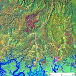
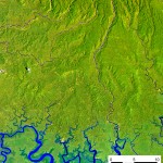
2. Two satellite images from Gulf Province – 1988 and 2002
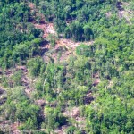
3. Photo of lowland logging
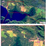
4. Two satellite images showing oilpalm in Milne Bay, 1990 and 2005
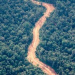
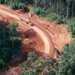
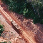
5. Three photos of logging roads in Western Province
6. A short video of logging operations in New Britain

